Shipping Estimate
USA
- USA
- CAN
- USA
- CAN
Ships within 48 hours · Estimated delivery Jul 7 - Jul 12
For Your Every Summer RSVP, with Code: SUMMER15
Description
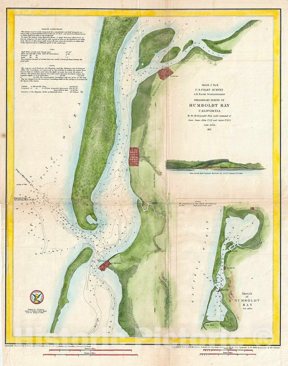
Historic Map : U.S. Coast Survey Chart or Map of Humboldt Bay, California, 1851, Vintage Wall ArtThis is an attractive 1851 coastal map or nautical chart of Humboldt Bay, California by the U. S. Coast Survey. It covers from Indian Island and Samoa south to Fields Landing. The cities of Eureka, Humboldt and Bucksport are beautifully detailed along with other inland features. An inset in the lower right quadrant features a sketch of Humboldt Bay while an elevation profile of the View of Red Bluff Entrance in Humboldt Bay is included above the
This is an attractive 1851 coastal map or nautical chart of Humboldt Bay, California by the U.S. Coast Survey. It covers from Indian Island and Samoa south to Fields Landing. The cities of Eureka, Humboldt and Bucksport are beautifully detailed along with other inland features. An inset in the lower right quadrant features a sketch of Humboldt Bay while an elevation profile of the View of Red Bluff Entrance in Humboldt Bay is included above the inset. The chart features numerous depth soundings and sailing directions. Produced in 1851 under the Supervision of A. D. Bache, the most influential leader of the Coast Survey.
Shipping Notes
- Free Standard Shipping on $100+ Orders to the USA.
- Except Preorder products are shipped in 48 hours.
- Delivery to the USA:
- Standard Shipping : 3-10 business days
- If time is of the essence, please consider selecting expedited delivery for faster service.
Exchange/Return Notes
- We offer a 30-day return/exchange service after receiving.
- Final sale items are not eligible for returns or exchanges.
- To process your return/exchange, please contact us at [email protected]
- Please click here for more details>>> Return & Exchange Policy